


- Distance 148 km
- Time 2 h 20 m
- Speed 0.0 km/h
- Min altitude 0 m
- Peak 0 m
- Climb 0 m
- Descent 0 m
Route Description
Greenlane McDonald's starting point.
Then heading south to Raglan via Highway 22.
This highway has a lot of subsidence on corners so pick your lines correctly abd be mindful.
2 rest stops:
Les Batkin reserve and Thunder cross valley
Route map
💡 Navigation Tip:
Your2Wheels maps are for viewing and sharing routes. To follow this ride on the road, download the GPX or KML file and open it in your preferred navigation app, such as Beeline Moto, Garmin, TomTom, Scenic or OsmAnd.
If this route includes Waze buttons, they navigate to individual locations only and cannot navigate the entire route.
Your2Wheels maps are for viewing and sharing routes. To follow this ride on the road, download the GPX or KML file and open it in your preferred navigation app, such as Beeline Moto, Garmin, TomTom, Scenic or OsmAnd.
If this route includes Waze buttons, they navigate to individual locations only and cannot navigate the entire route.
Enjoy this route? Why not organise a ride and invite other members to join you!
🗓️ Organise a Ride on this Route
- Distance Instructions
Photos
Waypoints
Greenlane McDonald's
Altitude: 0 m
Great meeting spot
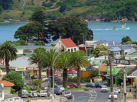
Raglan
Altitude: 0 m
Park up on the grass island on the main drag
Les Batkin Reserve
Altitude: 0 m
Address:
2817 River Road, Tuakau 2121, New Zealand
Public toilets
Thundercross Valley
Altitude: 0 m
Address:
3068 Highway 22, Glen Murray 2695, New Zealand
Has a gravel driveway. But coffee and toilets if needed.
Enjoy this route? Why not organise a ride and invite other members to join you!
🗓️ Organise a Ride on this Route
Please log in or join Your2Wheels to leave a comment.
Log in or Join free